Digital Knowledge System
Resilience to coastal erosion for people and nature
Ireland

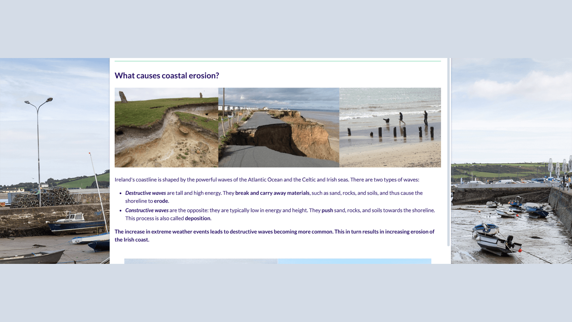
The innovative solution will provide nature-based measures to mitigate coastal erosion while ensuring sustainability and economic viability, preserving coastal activities and infrastructures. The solution is supported by the scientific understanding of coastal processes and sediment dynamics in terms of diminishing the risk of failure and to amplify the positive impacts. The collection of data methods, including DGPS surveys and cameras, aid the development of a decision support system ready to help resilient coastal management.
The innovative solutions will be completed by social innovation to promote citizen science and enhance citizen engagement in biodiversity restoration and climate-change adaptation: (1) engage with citizens and stakeholders to enhance understanding of needs and challenges of the coast; (2) engage with beach users to enhance understanding of coastal (physical) processes and of impact of storms and erosion; (3) build a trust-based relationship with local communities.
Main Target
Resilience to coastal erosion
Transformative Impact
This innovative solution will increase the collection of real time and accurate data and will support the decision taken for coastal protection. The role of this solution is also to collect data after the installation of some NbS in monitored areas and to measure the impact of the solution.The impact of the demo will be described at the end of the project implementation. During the implementation of the project in a specific area some intermediary results will be delivered, and all these results will be published to support the dissemination and the sustainability of the project.
Implemented Actions
Monitoring Infrastructure Deployment
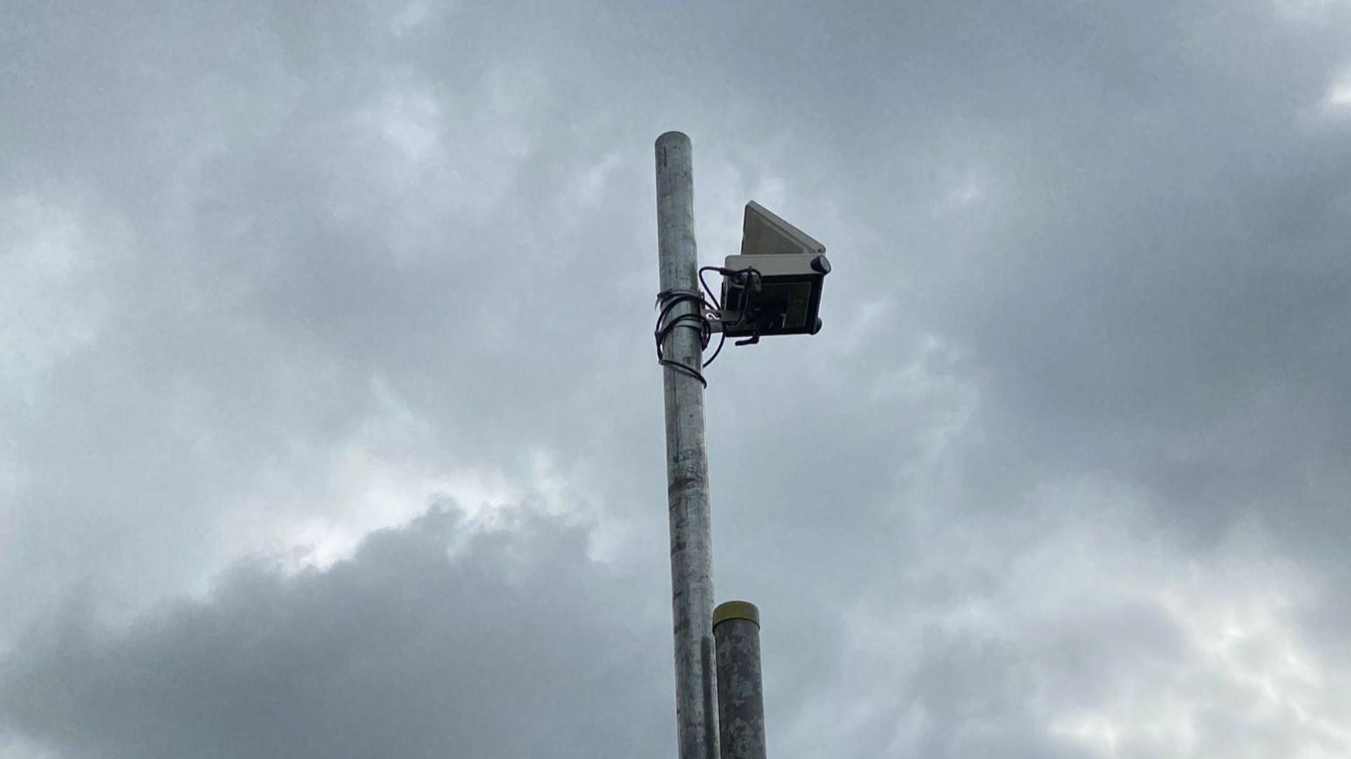
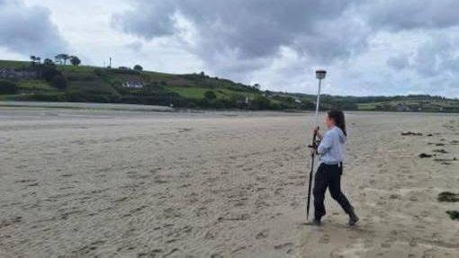
Centimetre-resolution DGPS surveys at Inchydoney Strand and Pilmore Beach establish baseline coastal morphology and track seasonal and storm-driven change, while a rugged fixed video camera at Inchydoney captures continuous imagery of tides, storms, sand movement and visitor use.
Citizen Science Engagement
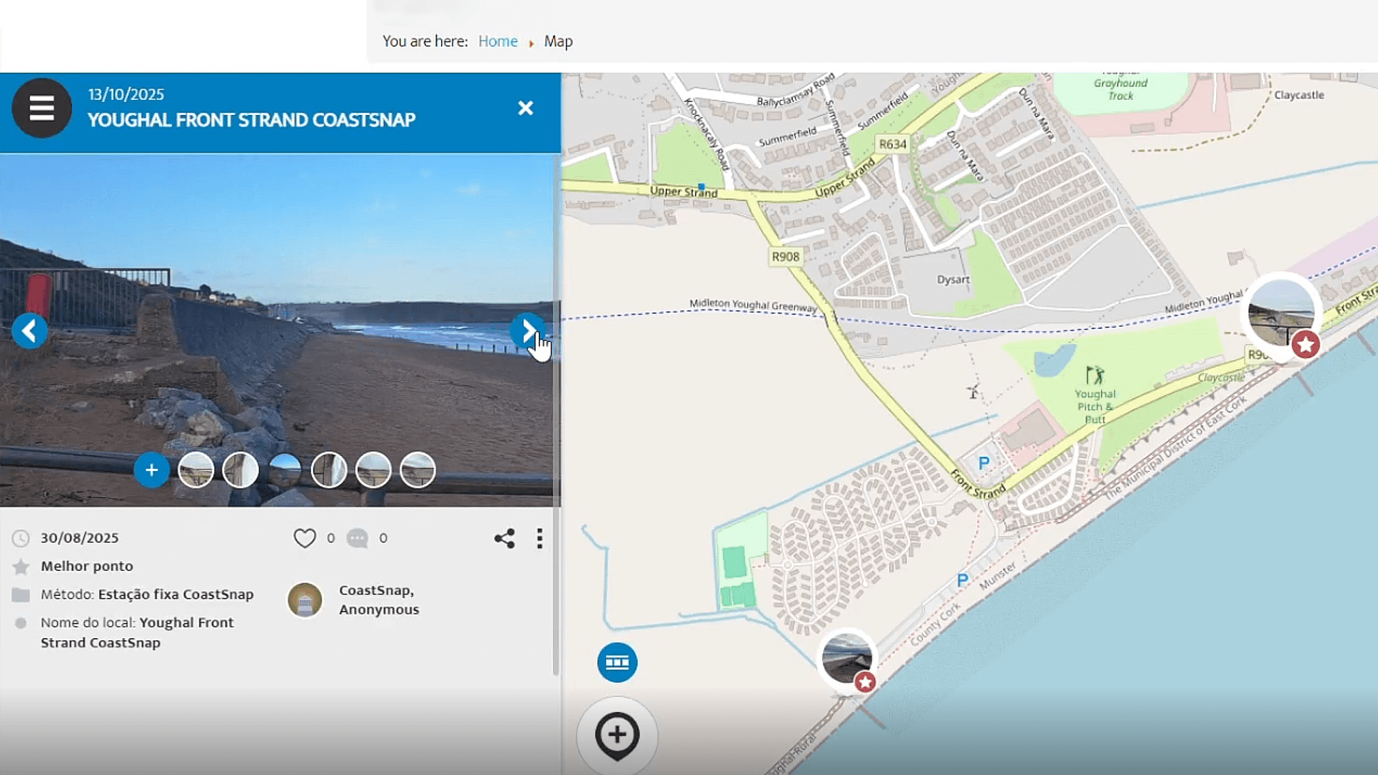
A tailored Maptionnaire tool guides East Cork residents through spotting, recording and reporting local erosion hotspots, and two CoastSnap stations on Youghal Beach invite visitors to capture standardized geotagged photos that feed the shared dataset.
Educational Outreach and Signage
Maptionnaire’s in-app tutorials coach users to recognise erosion features, while CoastSnap cradles feature clear on-site instructions that teach beachgoers exactly how to contribute imagery and observations.
Activating Research and Innovation with Data
DGPS profiles and drone validations underpin student-led beach dynamics modelling, hourly video imagery feeds a 3D shoreline model to refine storm impact forecasts, and harmonised CoastSnap and Maptionnaire datasets power machine-learning algorithms that anticipate erosion hotspots.
Key Indicators
Number of users